Overview of Costa Rica - And A Map
This map shows the major roads of Costa Rica. The cities shown are not necessarily large, but are important for road signs when driving towards an area or for planning a sensible route for internal flights or bus trips.
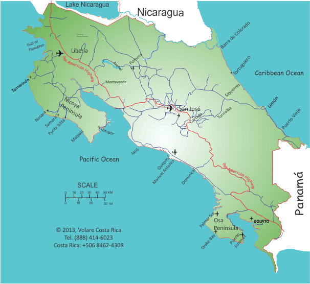
POPULATION CENTERS: San José is in the center of the Central Valley. 80% of the population lives in the Central Valley, which includes cities like Alejuela, Heredia, Tres Rios, Escazú, Santa Ana, Ciudad Colón.
ADDITIONAL POPULATION: Agriculture centers are Ciudad Quesada (also called San Carlos), Liberia, Cartago, Turrialba, Siquerres, and San Isidro General (also called Perez Zeledón). Turrialba and San Carlos/Fortuna are also volcano destinations so have good tourism opportunities; Turrialba has the Pacuare River and mountainous terrain for biking and canyoning and jungle hiking as well as a very active volcano.
PURELY TOURISM DESTINATIONS include Fortuna, Jacó, Tamarindo, Tortuguero, Barra Colorado, Puerto Viejo del Caribe, the Osa Peninsula, and over a hundred different beach destinations.
It may be a really exhausting day, but you CAN drive from one ocean to the other in only eight hours... and it takes a little longer to drive from Nicaragua to Panamá. If you do cross the border plan at least 4 hours delay for paperwork on both entry points. Your rental vehicle can't cross. Private vehicles need to get written permission from the Registrar's Office in San José within 10 days of departing Costa Rica, so it is a bothersome border crossing in either direction.